Energy and Meteorology Portal
Exposure and sensitivity to climate change, coupled with a relatively low adaptive capacity to offset system vulnerabilities can considerably increase climate risk. Therefore, it is important to quantify the risk posed by climate change and extreme weather events, to better address, plan, adapt and respond to their various, and sometimes compounded, associated threats.
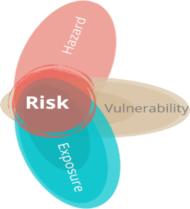
Risk is a combination of three components: hazard, exposure, and vulnerability (Figure 1, click on the blue dots for their definitions).
Subscribe to our newsletter:
A weather or climate hazard is a physical process or event (hydro-meteorological or oceanographic variables or phenomena) that can harm human health, livelihoods, or natural resources. They can be chronic or acute. Chronic hazards are long-term pattern shifts in precipitation, temperature, ice melt or sea-level rise. Acute hazards are isolated events, such as floods, landslides, wildfires, storms, heat or cold waves, droughts, and extreme precipitation. However, this is just a nominal distinction as in reality extreme events are part of the natural oscillation of the system as it transits to a different climatic regime, and chronic hazards will occur along the direction that such change is taking, e.g. if moving toward a dryer climate, extreme droughts will increase in frequency. But, as the system is oscillating, some years flash floods may occur in between droughts at earlier stages (Viner et al., 2020, IPCC, 2014).
These hazards can be described using climate indicators drawn from climate models, that can help us to understand the potential that hazards have to cause loss of life, injury, or other health impacts, as well as damage and loss to property, infrastructure, livelihoods, service provision, ecosystems and environmental resources (UN-DDR, 2015). Often indicators such as return periods are used to quantify the frequency (and severity) of the hazards. A return period, also known as a recurrence interval or repeat interval, is an estimated average time of occurrence of successive events, typically acute hazards such as floods, landslides or storms (UN-DDR, 2015).
Vulnerability is the degree of susceptibility or predisposition and the lack of capacity to cope with and adapt to the adverse effects of weather or climate hazards. It is important to note that two assets can be equally exposed to the same hazard but have distinct levels of vulnerability. For example, a wind farm and a hydroelectric power plant that are exposed to the same drought will have different impacts: while the impact on wind farm will be minimal, the impact on hydro-generation will likely be significant.
Sensitivity determines how the exposed asset is affected when hazards occur. Higher sensitivity implies increased physical and financial impacts related to climate hazards. Grouping assets by sector and identifying the most sensitive sectors can provide a quick, high-level assessment and help prioritize assets for further in-depth analyses.
Sensitivity is part of an asset’s vulnerability, but it must be combined with adaptive capacity to get the full picture.
Adaptive capacity is the ability of a company, sector or region to adjust effectively to weather and climate hazards. A system with a high adaptive capacity would be able to cope better with, and perhaps even benefit from, changes in the climate, whereas a system with a low adaptive capacity would be more likely to suffer from the same change. For example, establishing a hydroelectric power plant in a location where increased rainfall is expected in the future could be a good strategy, providing that all the other conditions for project development are fulfilled.
Exposure is determined by location and is linked to the hazard probability, intensity and frequency at a certain location. It includes the presence of people, livelihoods, species or ecosystems, environmental functions, services, and resources, infrastructure or economic, social, or cultural assets that could be adversely affected in a certain place.